
Culloville Road
Crossmaglen
Proposed Mixed use Development
Engaging Community Feedback
Overview


Application Site
The site comprises approximately 2.8ha of the mixed use zoning off Crossmaglen’s Culloville Road. It is laid out in four fields that are orientated from north west to south east. Each of the fields rises gently from Culloville Road, to the north west, however the general terrain falls in a south westerly direction.
The site lies on the periphery but inside the settlement limit, on the outskirts of Crossmaglen. The area is characterised by economic uses and suburban housing, strung along the roadside.
There are areas of peatland and a local wildlife site in the area, but overall the area is not sensitive and the proposal will not likely include heavy industrial operations that could generate harmful effluent or emissions.
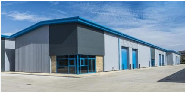
The Proposal
This proposal seeks to develop vacant zoned land on the outskirts of Crossmaglen. Outline planning permission is sought for a mixed-use development that could include up to 8 economic development units. The proposal has the potential to create just under 60,000 sq ft of commercial floorspace, with provision for approximately 120 parking spaces and approximately 20 HGV parking spaces.
Our aim is to foster community engagement and feedback, ensuring that the views of local residents contribute to the development process.
Concept Plan
The concept plan shows how the development could be laid out on the proposed site. It indicates potential for 8 commercial units that range from 5,000 sqft to 20,000 sqft, with access onto the Culloville Road.
This layout is conceptual only and is subject to change throughout the application process. A fully detailed layout will be designed at Reserved Matters stage should this proposal be granted Outline planning permission.

Planning Policy and legislation
The proposal aligns closely with local and regional planning strategies. As this proposal is categorised as 'major' owing to the site area, it has been preceded by a proposal of application notice (PAN) as per legislative requirements. The Banbridge, Newry & Mourne Area Plan 2015, is the Local Development plan. Within the plan the the site has been zoned for mixed use development (CM 11, outlined in red on the map) and holds a number of key site requirements for the site. Various planning policy statements will be considered as part of this proposal including PPS2 - Natural Heritage, PPS 3 - Access, Movement and Parking and PPS 4 - Planning and Economic Development.


Telephone Number: 02830835700
CONTACT
US
O'Callaghan Planning
Tel. 02830835700
Enquiries@ocallaghanplanning.co.uk
20 Castle Street,
Newry,
BT34 2BY
VISIT
US
Monday 9:00 - 17:30
Tuesday 9:00 - 17:30
Wednesday 9:00 - 17:30
Thursday 9:00 - 17:30
Friday 9:00 - 17:30
Saturday - Closed
Sunday - Closed